Member Spotlight: Frank Conkling
We’re continuing to bring you the Member Spotlight series to help us all get to know each other better! Do you know a WLIA colleague who deserves to be featured? Please fill out this form so that we can highlight them!
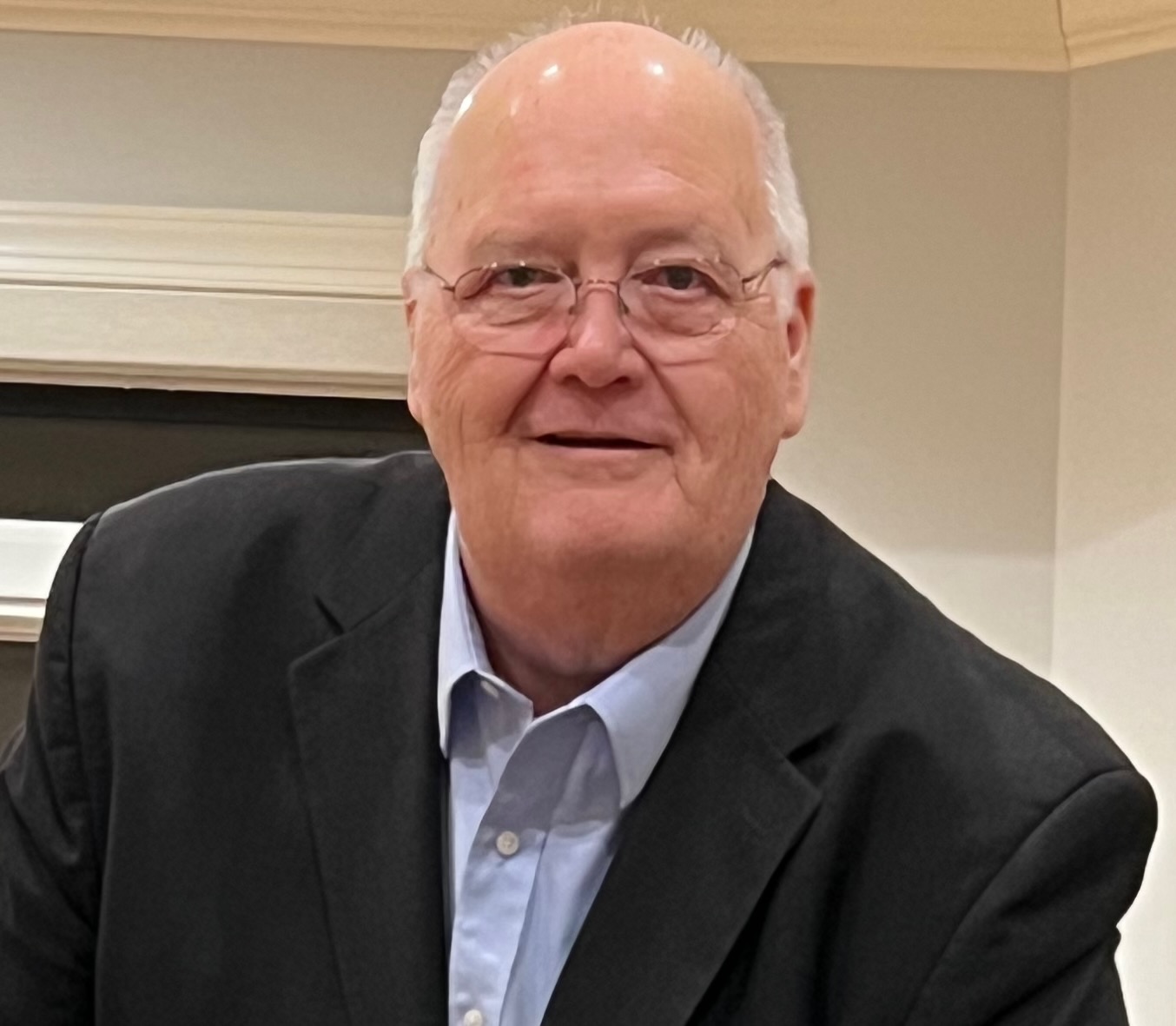
Today I'm happy to introduce Frank Conkling, owner of Panda Consulting. Many of us have been privleged to work with Frank or at least have seen him at WLIA events; we are very thankful for his sponsorship over the years and for the workshops he's given. Please take this opportunity to get to know Frank even more!
How did you come to your current profession or job?
After working for 25 years at the John D. and Catherine T. MacArthur Foundation, a major non-profit organization with worldwide commitments, as their Land Surveyor, GIS Administrator, and Land Information Director, I left to found Panda Consulting. Panda Consulting is a small, focused firm specializing in land record-related professional services, including strategic planning and parcel mapping services, Esri Business Partner services, and training and support. I was introduced to GIS soon after receiving my Florida professional surveying and mapping license in 1984 and have known many Esri employees for decades.
What’s your favorite part and least favorite part of your job?
It can be frustrating to see organizations struggle with outdated workflows, insufficient resources, or decisions driven by short-term cost considerations rather than long-term data quality and sustainability. After decades of working in this field, the most rewarding moments come from helping people do their jobs better; the least rewarding moments are when bureaucracy, limited vision, or lack of understanding prevent those improvements from happening as quickly as they should.
The least favorite part of my job is dealing with the parts of consulting that take me away from being able to help others envision how to perform their tasks better. I enjoy solving complex parcel mapping problems, improving workflows, helping organizations modernize their land records systems, and teaching others how to use technology more effectively. The challenging part is navigating the administrative side of the business—marketing, sales, proposals, budgeting, scheduling, and the constant effort required to explain the value of specialized GIS and cadastral expertise to organizations that may not fully understand the complexity behind maintaining accurate parcel data.
What’s the best advice someone has ever given you?
I would suggest there are two that I hold dear:
“If you do good, you will do well.”
The concept of “if you do good, you will do well” is the belief that a commitment to doing the right things—helping others, providing value, acting with integrity, and taking pride in your work—ultimately leads to personal and professional success.
It is not the idea that good actions automatically produce immediate rewards. Instead, it reflects a long-term philosophy: people and organizations that consistently create value, build trust, and treat others fairly develop strong reputations and lasting relationships. Those relationships often lead to opportunities, because people want to work with those they know, respect, and trust.
In a professional context, it means focusing less on chasing short-term gains and more on serving others well. If you help clients solve meaningful problems, share your knowledge, stand behind your work, and make the people around you more successful, success tends to follow. Your reputation becomes your greatest asset.
For example, in consulting, “doing good” means more than delivering a project. It means understanding a client’s challenges, recommending the right solution even when it is not the most expensive option, teaching people so they can become more capable, and leaving their organization better than you found it. Over time, that approach creates loyal clients, referrals, and opportunities.
The philosophy also recognizes that success is not just measured by money or recognition. Doing good means creating something worthwhile, helping others succeed, and finding satisfaction in knowing that your work has a positive impact. The “doing well” part is the natural result of consistently doing meaningful work with honesty and excellence.
The other is: “Always leave things better than you found them.”
That advice applies to everything—projects, organizations, data, and people. Whether I am helping a county modernize its parcel data, improving a workflow, or training someone, the goal is always to create something that is more accurate, efficient, and sustainable than it was before.
What do you like to do for fun? (Hobbies, volunteer work, etc.)
I enjoy being curious, reading books, and learning about everything. I like taking things apart, understanding why they work the way they do, and finding ways to improve them. My idea of fun is probably different from most people’s—I can spend hours thinking about the world, the future, and how emerging technologies will impact our lives and future generations. I enjoy creating, learning, and helping others see possibilities they may not have considered before.
Would you like to speak on your perspectives on the future of land information professions in terms of our changing world and technologies?
GIS is changing faster than ever, and that’s exciting. In the past, our job was mostly about creating and maintaining data and the resultant maps. Today, we’re helping organizations understand and manage the world around them. GIS has become the foundation for making better decisions about land, infrastructure, public safety, natural resources, and much more.
New technologies like artificial intelligence, drones, cloud computing, and digital twins aren’t replacing GIS professionals—they’re giving us better tools. AI can help automate repetitive tasks, but it can’t replace the experience and judgment needed to solve real-world problems. People will always be needed to ask the right questions, make important decisions, and ensure data can be trusted.
As our world becomes more connected, GIS professionals will spend less time making maps and more time managing information, building smarter systems, and helping people solve complex problems. The future belongs to those who are willing to keep learning, adapt to new technology, and remember that GIS isn’t just about maps—it’s about helping people make better decisions.
What’s something most people wouldn’t guess about you?
Most people wouldn’t guess that someone who spends so much time working with GIS and technology is really a philosopher at heart. I love understanding the stories behind how we all interact with one another, shaping the landscape and society we see today. The real fascination is the connection between people.
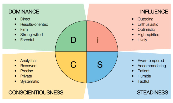
Have you taken or studied the “personality colors” or DISC and things of that nature, which analyze different types of people and our behaviors? I’ve found that all fascinating as well!
Interesting that you brought that up. I tend to think of myself as an "I/C" with minor "D" influences, with strengths in leadership and communication. I think of myself as able to quickly analyze situations while leaning toward education and empathy as the primary means of persuasion and showing the way, rather than demanding that change occur. When interacting with clients, after explaining technical issues, I often offer multiple options and allow them to develop strategies to move forward. I often share a story in which a manager of mine would chide me for attempting to educate them when they were only requesting the information. He would ask for directions to the hospital, and I would, in his words, “tell him how to do brain surgery.” I am driven to leave any interaction with the other person knowing more than when we started.
Where would you most like to travel to and why?
I would most like to travel to Italy. I am fascinated by history, geography, and the relationship between people and land, and Italy is essentially a living map of thousands of years of human settlement. I would love exploring the historic cities, rural landscapes, old boundaries, and the stories behind how places developed over time.
Another possibility is Scotland and Ireland, where many of my ancestors came from. Their landscapes, historic land records, boundary traditions, and connections to surveying and land ownership are fascinating. The combination of rugged landscapes, ancient settlements, and rich history would make it an incredible place to explore—not just as a traveler, but as someone interested in how people have defined and documented land for generations.