
Foundational Layer StoryMap and Dashboard Now Available
The WLIA Technical Committee has developed two new applications that showcase progress on Wisconsin’s foundational layers and make statewide data tracking more accessible: the Address Point and Road Centerline Spotlight StoryMap and the Foundational Layers KPI Dashboard. Together, these tools give stakeholders throughout Wisconsin’s land information community a transparent view into the status and maintenance of foundational datasets.
What Are Foundational Layers?
Foundational layers are the geospatial building blocks of Wisconsin’s land information ecosystem. These include:
- Parcels
- Address points
- Road centerlines
- PLSS
- Municipal boundaries
- LiDAR
- Hydrography
- And other statewide datasets essential to government operations
They support everyday workflows such as:
- NG911 & emergency routing
- Transportation planning
- Broadband mapping
- Permitting & zoning
- Environmental monitoring
- Utility management
- Open data and transparency initiatives
Without accurate, continually maintained foundational layers, local and statewide systems simply cannot operate effectively.
Why Tracking These Layers Matters
The layers are scored each year on categories such as statewide completeness, accessibility, update cycles and discoverability. Tracking foundational layers statewide helps:
- Identify gaps and inconsistencies
- Prioritize updates and modernization
- Improve data discoverability and accessibility
- Support statewide initiatives
- Help municipalities showcase the value of their land records investments
- Strengthen coordination across governments and agencies
Statewide Trends & Metrics
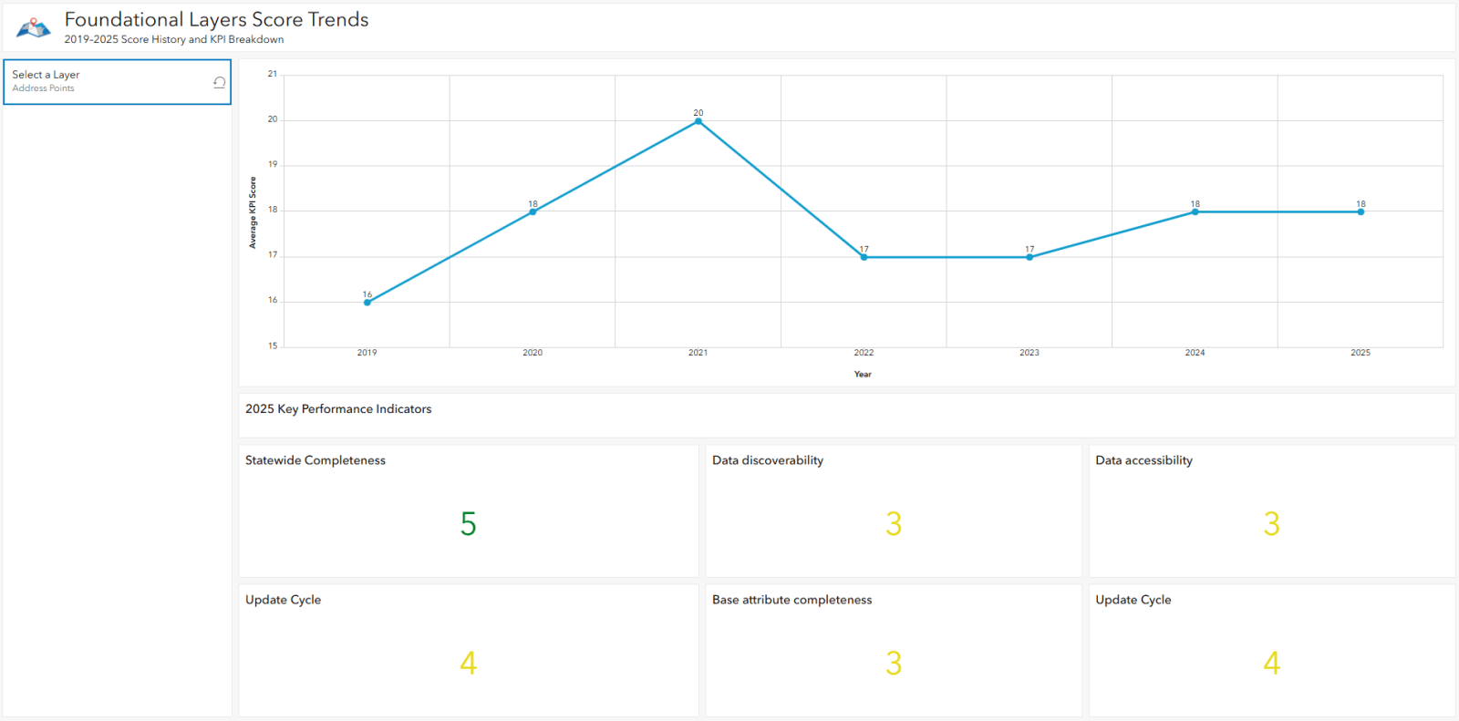
The Dashboard includes historical KPI trends from 2019–2025.
Metrics like these make it easier to demonstrate statewide progress, identify where more support is needed, and strengthen Wisconsin’s land information system.
Explore the Applications
WLIA members are encouraged to explore and share the Story Map and Dashboard:
Address Point and Road Centerline Spotlight StoryMap
Foundational Layers KPI Dashboard
If you want more information, want to provide feedback on these applications, or are interested in becoming a member of the WLIA Technical Committee, please contact Mike Vander Sanden, 2026 Technical Committee Chair.