Welcome to the Winners' Circle! - 2022 WLIA Map Contest Awards
It was wonderful to see map submissions again at the WLIA Annual Conference! 47 maps were either submitted virtually or delivered in-person at this year's Map Contest. We are grateful once again to have the sponsorship of Ruekert & Mielke, the volunteer help of numerous Association members, and contributions from numerous others to bring the contest to life!
To view all of the map entries, check out the 2022 WLIA Virtual Map Gallery.
If you want to contribute or make suggestions for future map contests, please contact the Map Contest Co-Chairs!
Wondering where the hand-drawn map contest entries are? Stay tuned for a future news post!
Special Awards
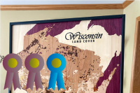
People's Choice & President's Choice
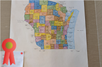
Laser Cut Land Cover Map of Wisconsin, Jim Lacy, WiscMapper.Net
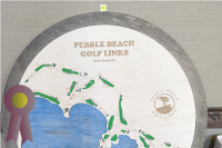
Best Private Sector Map
Pebble Beach Golf Links, Andy Bartell, On Par Engraving
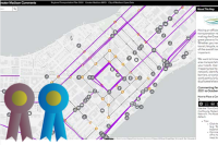
Best Public Sector Map
Connect Greater Madison Regional Transportation Plan 2050 Public Comment, Dan Seidensticker, Greater Madison MPO
Best Student Maps
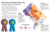
- Collegiate Division: The Future of Chocolate City, Aileen Clarke, UW-Madison
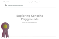
- K-12 Division: Exploring Kenosha Playgrounds, Violet and Nick Spittlemeister
Category Awards
Base & Reference Map
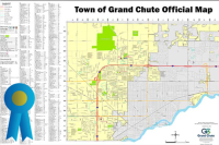
- Best in Category: Town of Grand Chute - Official Map, Tyler DeBruin, Town of Grand Chute
- Runner-Up: A Map of Wisconsin Counties, Brett Kingston, City of Marshfield
Thematic Map
- Best in Category: The Future of Chocolate City, Aileen Clarke, UW-Madison
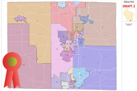
- Runner-Up: Rock County Tentative Supervisory District Plan Draft 2 and Beloit Area Demographics, Jennifer Borlick, County of Rock
Mapping Poster
Best in Category: Easter Eggs on the Dane County Bicycle Map, Dan Seidensticker, Greater Madison MPO
Black & White Map
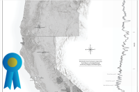
- Best in Category: The Pacific Crest Trail, Anna Peters, Robert E. Lee & Associates, Inc. (Private Project)
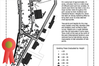
- Runner-Up: Riverside Park Black and White Tree Survey, Adam Wright, La Crosse County
Brochure & Small Format Map
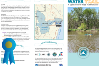
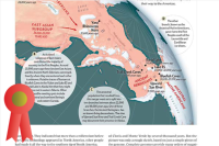
- Best in Category: Manitowoc River Trail, Anna Peters and Nicole Barbiaux, Bay-Lake Regional Planning Commission
- Runner-Up: Ancestral Branches, Daniel Huffman, somethingaboutmaps
Map Book & Atlas
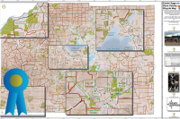
Best in Category: 2021 State of the System Report - Appleton (Fox Cities) TMA, Rachel Roth, East Central Wisconsin Regional Planning Commission

Most Unique
- Best in Category: Laser Cut Land Cover Map of Wisconsin, Jim Lacy, Wiscmapper.Net
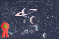
- Runner-Up: The Four Lakes Night Sky, Austin Novak, University of Wisconsin - Cartography Lab
Interactive Map
- Best in Category: Connect Greater Madison Regional Transportation Plan 2050 Public Comment, Dan Seidensticker, Greater Madison MPO
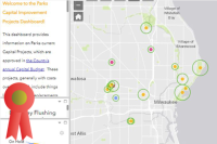
- Runner-Up: Milwaukee County Parks Capital Projects, Pam Nooyen, Milwaukee County Parks
Story Map
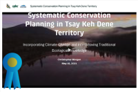
- Best in Category: Systematic Conservation Planning in Tsay Keh Dene Territory, Christopher Morgan, University of Northern British Columbia
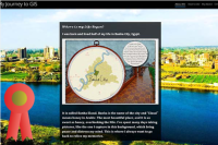
- Runner-Up: My Journey to GIS, Mai Ghaly El-Gazzar, Dubai Electricity & Water Authority